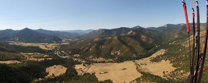
Woodrat Cup Pilot’s checklist
Do people know I am flying?
Pilots are strongly encouraged to have an InReach or Spot tracking device and to make sure that someone knows they are flying and can aid in non-life-threatening situations short of an emergency. If you don’t have a tracking device, make sure someone knows you are flying, and you can check in with after your flight and that this person knows who to contact if you are in trouble. Cell coverage is generally pretty good in the Applegate Valley along the task courses but is not guaranteed.
Am I familiar with the landing zones?
Read the site guide for Woodrat and in particular the description of LongSword and Wells Land LZs. The LZ’s including Donato are also included in this document.
Am I familiar with all the “no-land“ areas and the waypoints?
You can find links to display the no land areas and waypoints on Google Earth as well as links to OpenAir text files you can download to your flight instrument on this page of RVHPA’s website.
Am I familiar with the weather patterns and terrain and how they affect flying at Woodrat?
Rick Ray has written articles on the club’s website that provide insight on how to best fly the mountains around the valley. Click on the Understanding Woodrat menu and go to the webpages, Understanding Rabe’s Ridge, Burnt Ridge, and Flying to Donato’s. These can be very helpful.
Have I checked the day’s weather?
The RVHPA site has links to get weather information. Pilots should start with the National Weather service area forecast and then move on to the local forecasts in Windgrams or XC skies. Look in particular for signs of increasing valley winds in the forecast. Plan on being on the ground BEFORE they are forecast. Often you can hear reports from other pilots flying or landing at LongSword and the Hunter bailout LZ. There are weather stations at LongSword, Wells Land, and at the top launch. There are webcams at LongSword and on top launch. Here is the link.
What are things that might get me into trouble flying a particular task?
Check the caution notes associated with the different tasks on the website.
Where can I get more advice on how to fly the course?
The club has a group of “frequent flyers” that are out almost every good flying day. Ask them for advice on minimum crossing altitudes for crossings. They can also advise in the air over the local radio frequency relative to winds and top of lift.
