Last update:
3/4/2026
Special notes:
Emigrant Lake County Park is on US Department of Reclamation land, managed in cooperation with Jackson County Parks and Recreation.
IMPORTANT UNTIL FURTHER NOTICE:
Off highway vehicles have not been allowed above the high water mark since 1994 and more recently, the decision was made not to allow vehicles past the parking area at Patrick Dunn Beach. You must now park in the lot located at the end of the old highway 99 informal boat ramp. The trail is located past the vault toilet at the North end of the parking lot. Do not drive out to the training hill or you will be cited and fined.
The Basics:
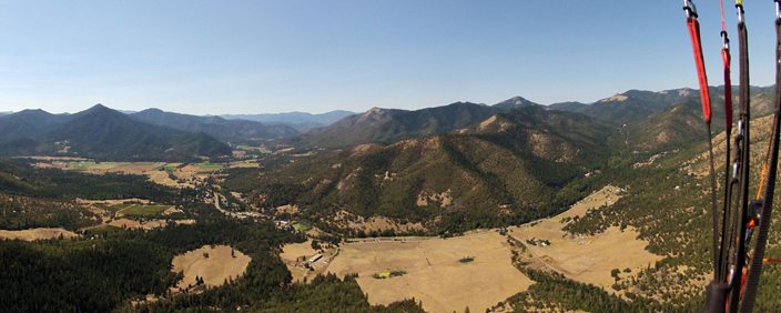
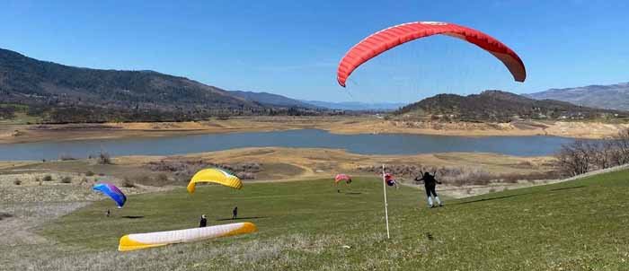
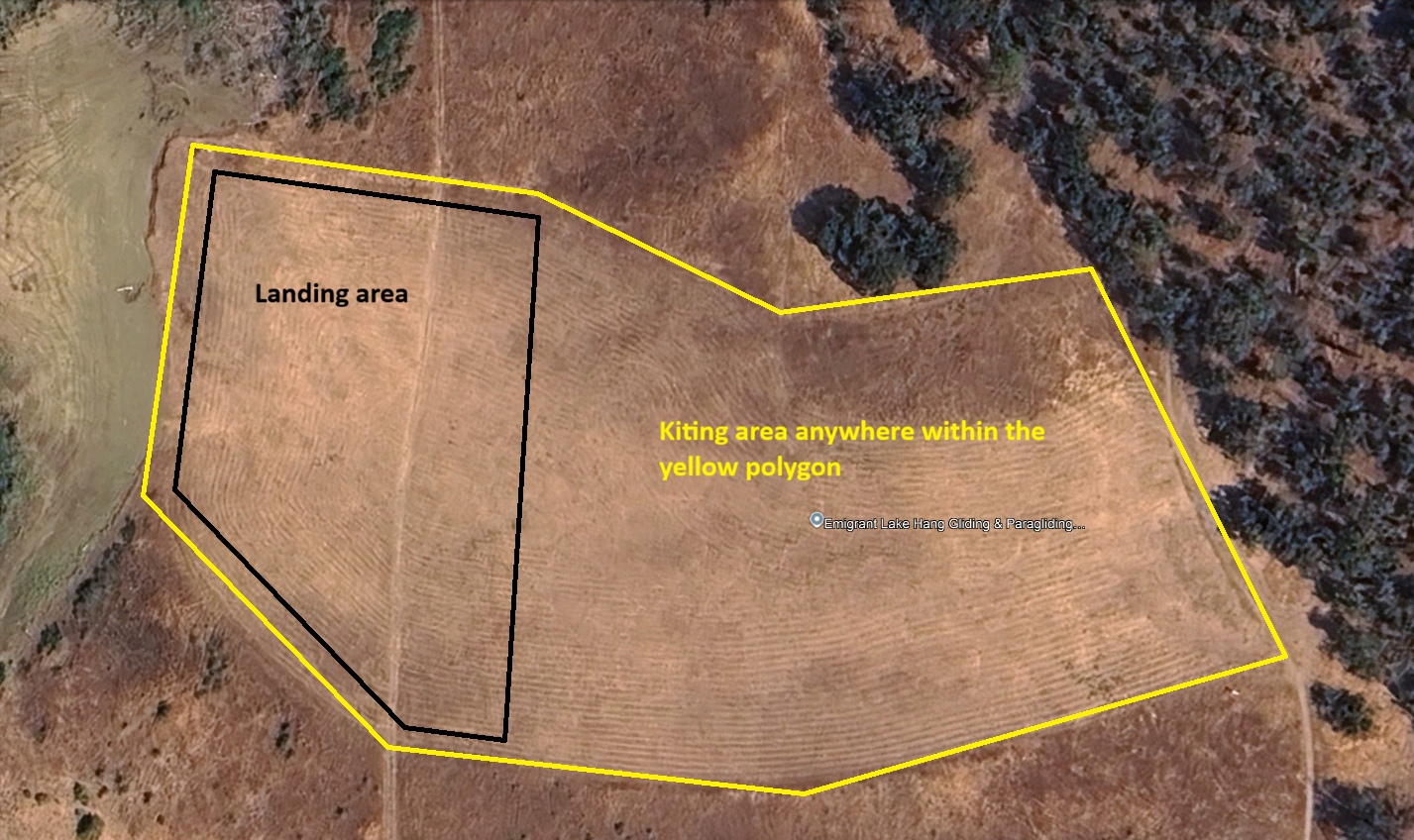
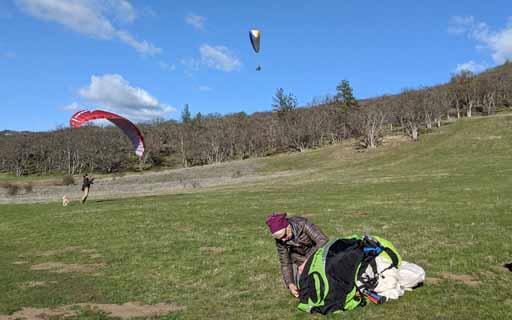
The hill at Emigrant Lake is approximately 80 feet in vertical height. The hill is very flat at the bottom with a gentle slope two thirds of the way up. The top steepens slightly providing an ideal launch for practicing take-offs. The air coming off the lake provides a somewhat predictable and consistent flow of air to practice kiting. Be careful not to overfly the LZ in the early Spring and Summer when the lake is high. Later in the season there is little risk of landing in the water when the lake has receded. There are hiking trails that cross at the top and bottom of the hill. This is public land so be careful of others using the area and keep your distance.
CAUTION! When winds exceed 10-12 mph, or when you observe whitecaps on the lake: people have been blown back here, experienced turbulence, and been seriously injured. The smooth winds and the grassy hill are often alluring to the inexperienced. Midday and summer time often present higher winds and turbulent conditions. Pilots and self taught individuals have been blown back into the surrounding oak trees and/or experienced deflations/accidents near the ground that have required medical attention.
Use respect, you’re in close proximity to the ground 100% of the time!)
Flight type(s): Training hill low altitude
Season: Year-round; best in spring, summer, and early fall.
Pilot proficiency: Minimum P2, M1 or P1 with instructor’s approval.
Glider restrictions: None.
Membership requirements: USHPA
Site Waiver: USHPA membership waiver applies.
Launch: 42°08’44.8″N 122°36’35.6″W
Wind direction(s) and speed: 230 to 300 degrees / 0 to 10 mph normal, above 10 mph with caution (could be blown back) for normal and mini wings. Speed wings may kite and launch in 15-18 mph winds.
Radios & Communication: Local frequency is 151.505 MHz (151.955 reserved for instructional use only). When 151.505 is busy with other traffic 151.925 is often used as an alternate.
Cell Service: Good signal
Emergencies: dial 911
Access: Park and walk in on trail, do not drive on lake bed.
Airspace & Air Traffic: No airspace restrictions in immediate vicinity. Private plane traffic is not uncommon.
Weather hazards:
Weather info: https://rvhpa.org/weather/
Waypoint & Google Earth Links:
More info: ParaglidingEarth, Leonardo
RVHPA Site Contacts:
Sam Crocker at Sundog Paragliding (503) 781-1785
Kevin Lee at Thermal Tracker Paragliding (541) 890-7142
Rules and Regulations:
Park at the designated area and walk to the site. DO NOT drive on the lake bed to the LZ.