An Article by Rick Ray
There you are, our young P2 or low experienced P3, happily flying around Woodrat. You are feeling all studly and excited about your flying prowess, when THE VOICE comes over the radio “ YOU are flying in a bad spot and YOU need to get out of there-now!”
“Oh, okay” ,some say.
“Dammit” say another. “Not again. Leave me alone”.
The point lying behind this well-intentioned advice is two-fold. First, the more experienced pilot is trying to keep you out of trouble. Secondly, they are trying to help you develop your own judgment skills so that you don’t get into a bad place in the first place, or, having gotten into such a place, that you recognize it as such and extract yourself posthaste. Hopefully, the more experienced pilot will seek you out after landing and help you understand why THAT PLACE was a bad place.
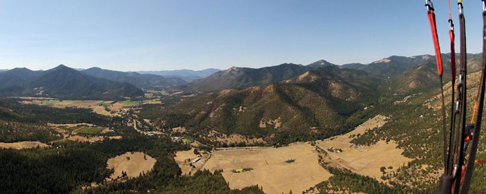
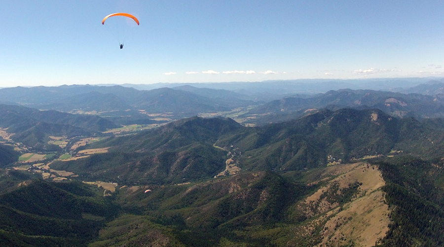
Until you develop this skill set, you really shouldn’t be attempting to fly in the upper regions of Rabies Ridge. You need to have the recognition software hardwired into your flying that is able to recognize and avoid “bad areas”. Flying towards Donato’s or attempting to navigate upper Rabies Ridge and tackling the Humbug crossing requires good judgment skills. Both are totally achievable goals and the flights have been successfully and safely made by literally hundreds of pilots through the years. Unfortunately, however, there have been numerous instances of pilots tackling those flights and ending up in trouble, reserve tosses, injuries, or torn up gliders. For those pilots, their recognition software was non-existent or temporarily on the blink- they didn’t realize fast enough that they had gotten themselves in a bad spot and failed to leave it soon enough.
With good judgment skills both flights are totally doable.
Next time you hear THE VOICE on the radio, instead of being resentful, hear it as an encouragement and a challenge to fly further and to fly safer by learning to recognize what a bad area looks like.
NAVIGATING UPPPER RABIES AND DEALING WITH HUMBUG.
Whether it is flying at Woodrat or any place else, the basic question is “What are the winds doing?”
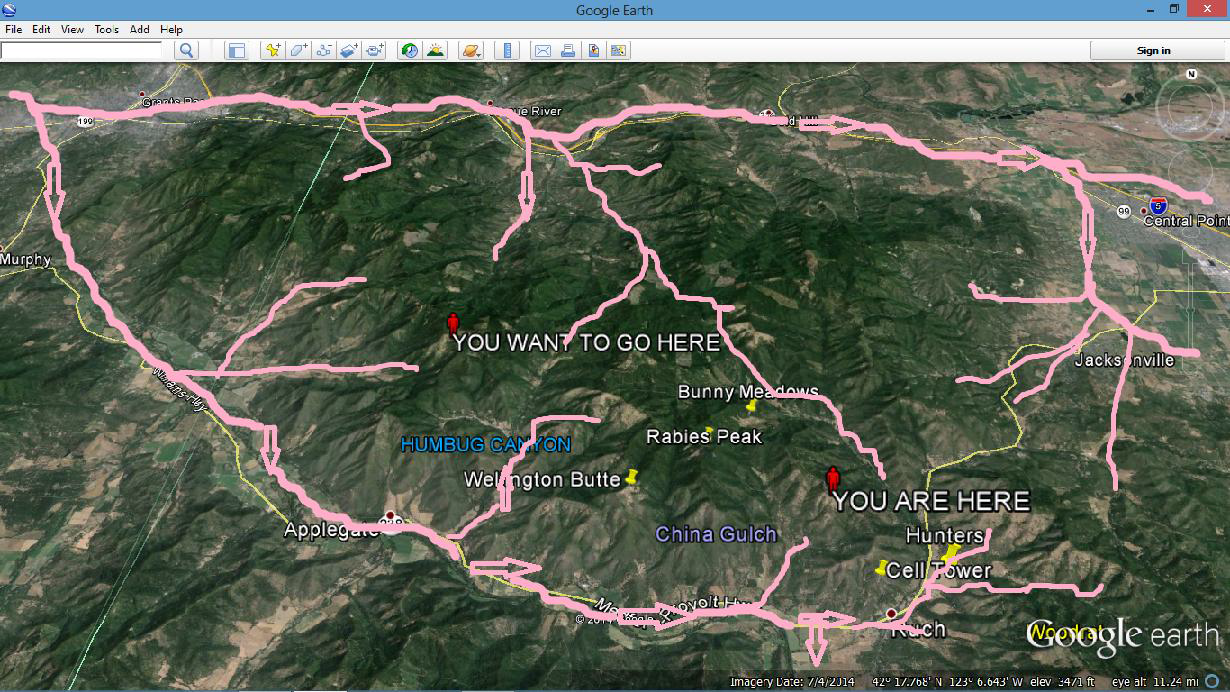
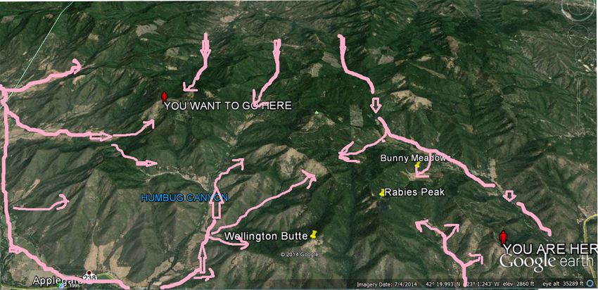
LARGE SCALE AREA WIND MAP
On a typical WEST up valley flow day, the winds flow out of the Grants Pass area and make their way up the two major drainages, the Applegate and the Rogue, as they flow towards the high ground.
ZOOMING IN ON THE HUMBUG AND RABIES RIDGE AREA
Basically, we have an area of competing windflows. Because of the drainage systems coming off of the Applegate and Rogue, the valley flow coming out of the Grants Pass area are frequently trying to merge. The coming together of these various up-slope flows results in this area being known for its convergences and its “uh… Texture.” The area is also known for the relative strong strength of its thermals especially in the area of Rabies Peak and Old Blue.
The most important point to have firmly fixed in your mind is that there is a lot of things going on with the windflows in the upper Rabies Ridge and Humbug canyon areas. An appreciation of these dynamics can make us more successful in flying across the area. The knowledge of how things are working can help increase our safety by helping us recognize areas that we should be cautious in or avoid altogether.
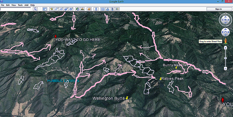
ROTOR AREAS UPPER RABIES AND HUMBUG MAP
Here is a closer look at the windflow with the known potential rotor areas represented by the light blue. Unfortunately, I have blundered into most of these or have watched wide eyed as others demonstrated exactly why one should stay out of those spots. It is a sobering thing to listen to grow men and women whimper! TO SAFELY FLY IN AND THROUGH THIS AREA REQUIRES GOOD JUDGMENT THAT COMES THROUGH EXPERIENCE. You need to be able to recognize quickly exactly what is happening with your immediate windflow and then accurately assess the impacts of that specific windflow as far as your near topography goes. Three questions should be churning through your brain: WHAT IS THE WIND DOING? AM I IN A CLEAN WINDFLOW? DO I HAVE SUFFICIENT GROUND CLEARANCE? If those questions are not floating around in the back of your mind then you are in the wrong area for this point in your flying career.
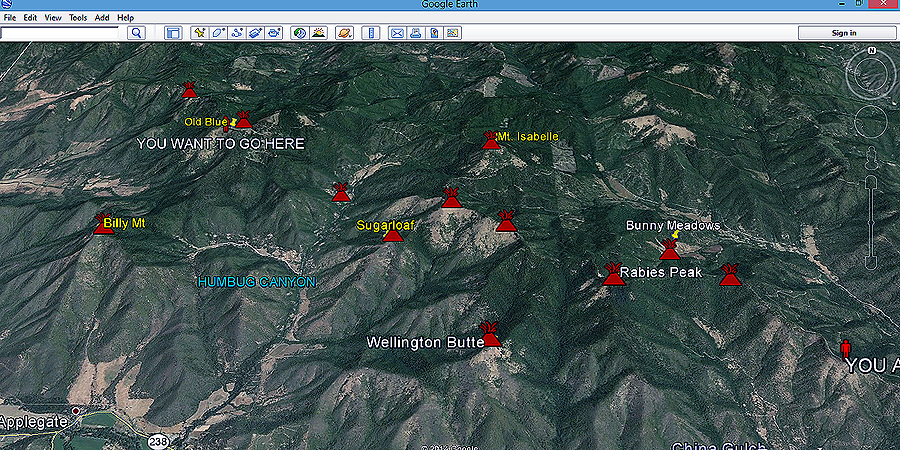
THERMAL MAP OF UPPER RABIES AND HUMBUG
Lest you think that this is all gloom and doom, the positive side is that the Upper Rabies Peak and Humbug area usually abounds with thermals because of the wind interactions. Here are the locations of some of them. Understand that these are general areas. The thermals are not tied to a tree and just waiting for you to get to Point X. But, these are great fishing spots and plenty of thermals have been caught here in the past. Bear in mind, that you might hook into a thermal that might be a little spicier than you like. The specific interface thermals near Rabies Peak, Bunny Meadows, Sugar Loaf, Old Blue will frequently be on the large side. My suspicions are that we are getting a merged thermal release coming out of the respective windflow zones? Kind of like a super release? Anyway, for whatever reason, the thermals coming off of these regions will occasionally be in the 1800 fpm range. The word “Yarded” comes into play at that point. As in “I was ripped or Yarded into the sky”. (while desperately seeking my mom!) But, you never know until you get there.
DEALING WITH HUMBUG DO’s and DON’Ts
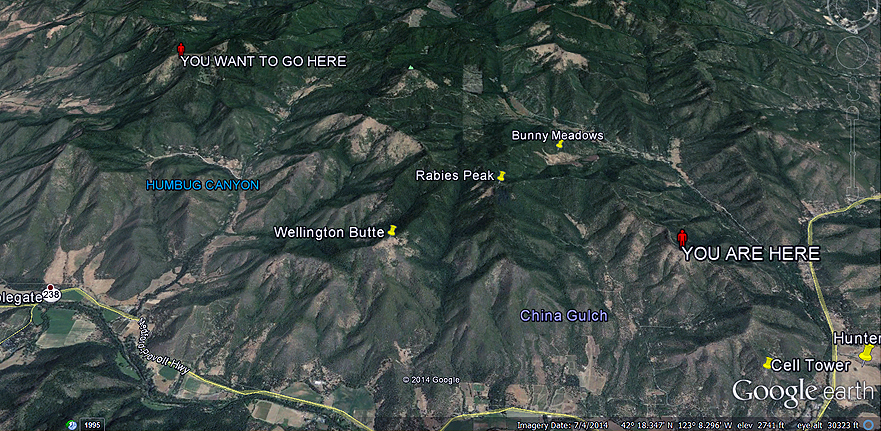
1. You can never be too high to cross Humbug! It is approximately 4 miles from Rabies Peak to Old Blue. It is approximately 2 miles from Sugarloaf to Old Blue. On any typical day you will be gliding against the valley flow spilling through the Slagle gap located between Old Blue and Billy Mt. I have been at 7500 feet and not made it. Conversely, I have sailed across with ease from 5000 feet. It is VERY wind strength dependent. In lighter valley flow days it is easier to cross.
2. DO NOT COME INTO OLD BLUE BELOW RIDGE HEIGHT! Your momma ain’t going to help you and you stand a good cause of getting your ass kicked by the rotor produced either by the winds flowing through the Slagle Gap or by the downstream thermal turbulence caused by a huge Old Blue thermal release or
by a combination of the above. In either case, DON’T CONTINUE TO PUSH IN IF YOU GET BELOW RIDGE HEIGHT.
3. DO NOT GET WIND SHADOWED AT BILLY MOUNTAIN. The wind is coming from the Grants Pass area. Make sure that you sure above the top and be careful on all the ridges and protrusions as the local winds can sharply vary. If you bomb the crossing to Old Blue, DO NOT try to sneak immediately behind Billy on the way to the mouth of Humbug. If you bomb, try instead to follow the Humbug side of the Wellington Butte ridge. It is frequently possible to get back into the game and find a thermal because the upper level valley flow is pushing lift over to that area as it spills over into the China Gulch area.
4. Don’t let yourself get below the grassy slope between Rabies Peak and Sugarloaf. There is a nasty wind blocked rotor that forms behind Sugarloaf. And the lift getting pushed over the corner towards Rabies Peak is frequently quite textured. The glide out to a safe landing zone is really puckering.
5. There are some bailout landing areas in the lower Humbug canyon. Just remember that Humbug has an up canyon flow with a crossing upper flow from the West. Don’t get wind shadowed by Billy. There is a largish field that lies just across Hwy 238 at the mouth of the canyon. You really do not want to land in Bunny Meadows as it is a significant thermal release area. If you are in the vicinity of Rabies Peak, your bailouts are Hunters or Longswords. Remember that you want to be at least 200 feet over Wellinton before running towards Longswords. It puts you above the resident rotor that lies behind Wellington on the China Gulch side.
6. This is a fun and challenging area to fly. I always look at my flights into the upper Rabies Ridge and Humbug areas as being special. It’s like being given a box of Crackerjacks- you never know what the prize is going to be. I might be able to continue on to Grants Pass. I might tuck my tail and run. You just never know.
Safely flying Humbug and upper Rabies Ridge requires good judgment.
Rick Ray January 10, 2015
