Last update:
July 3, 2024
Dan Wells
The Basics
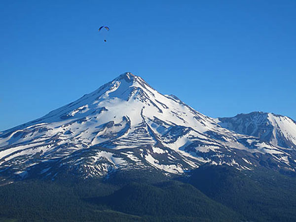
Michael Zanger flying at The Whaleback in July 2010
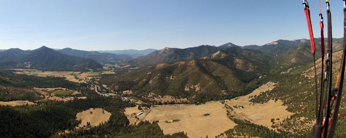
The Whaleback, located just north of Mt. Shasta on the Klamath National Forest, is an out-of-the-way flying site known for excellent evening flying and cross-country potential.
Flight type(s): Thermal, XC, Glass-off
Season: Summer & early fall (when access road is clear of snowpack)
Glider Restrictions: “Speed” or “mini” wings are not recommended.
Pilot proficiency: USHPA P3/H3 minimum ; P2/H2 only under appropriate conditions with mentor or instructor present. Flat slope launch (FSL), cliff launch (CL), high altitude (HA), and turbulence (TUR) special skill endorsements are recommended for all pilots.
Membership requirements: USHPA and RVHPA memberships are requested but is optional.
Launch: 41.534, -122.153 (41° 32.118’N, 122° 9.156’W); Elev. : 7437 ft. (2267 m.); Flat slope launch on gravel.
Wind direction(s) and speed for Whaleback: 260 to 300 degrees. 3-14 mph for paragliders 10-20 mph for hangs. Ideal windspeed is 7 mph for paragldiers and 10 mph for hangs. Ideal wind direction is straight in.
Primary LZ: 41.5505, -122.2 (41° 33.030’N, 122° 12.000’W); Elev.: 4480 ft. (1364 m.); GR: 4.8
Radios & Communication: Local frequency is 151.505 MHz; cell service is good on launch but variable in LZ depending on carrier.
Emergencies: Dial 911.
Access: 2WD accessible via US highway, paved and dirt US Forest Service roads (after snowpack has melted).
Airspace & Air Traffic: No airspace restrictions in immediate vicinity; sail plane traffic is common in the area and over launch. Klamath Falls airport and military operation areas along XC routes have airspace restrictions and/or possible military air activity, including fighter jets.
Landing Restrictions: Landing in the Lava Beds National Monument is prohibited and you may be arrested and have gear confiscated. Do not land in crop fields.
Weather hazards: Over development, cloud suck, strong desert conditions, dust devils, thermic LZ, high winds, density altitude.
Weather info: NWS Forecast for LZ, SoarCast, Grass Lake webcam
More info: ParaglidingEarth, Leonardo
Site contact: There currently is no designated site contact. Check the club’s Telegram group for latest information and updates not published here,
Rules & Regulations
The Whaleback launch and primary LZ are both located on public Klamath National Forest lands and all National Forest rules and regulations apply. Smoking outside a vehicle is not permitted during periods of high fire danger (which is essentially the entire flying season here so please don’t smoke outside). A fire permit is required for any campfire or camp stove use in the area year-round.
Please drive slowly and attentively on the way to launch and LZ. Backroad traffic may be heavy during logging operations, firewood cutting season, and in fall during deer hunting season.
Flying The Whaleback
Welcome to The Whaleback flying site. In the interest of preserving this remarkable flying site and to promote safe flying, we have prepared this guide to assist pilots in getting the most out of their time at The Whaleback. It is no substitute for a thorough site introduction from a knowledgeable pilot. As always, use your own judgment in determining whether it is safe or appropriate for you to fly the site under current conditions. If you are unsure, do not fly.
Conditions
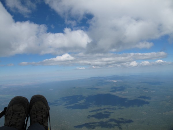
The Whaleback is an inland high altitude, high desert flying site that has changing weather conditions throughout the day and is often very strong and demanding. A typical day begins with calm conditions in the early morning, increasing thermal development and accompanying winds during late morning, and well-developed thermal cycles by noon. Early afternoon brings on even stronger conditions, cumulus cloud development, and shifting wind gradients. Mid afternoon conditions can be very strong and turbulent, even if winds are relatively light on the surface. By late afternoon thermals begin to lose strength and winds usually slow by mid-evening evening, often making for smooth evening flying suitable for pilots of all skill levels. Winds often go catabatic in late evening.
The Whaleback often overdevelops, sometimes forming cumulonimbus clouds fairly early in the day. This tends to happen during periods of hot, stable weather when an upper level cold front has moved into the region and during periods of monsoonal flow. South winds often accompany this weather pattern which may persist for several consecutive days. Keep an eye on the sky and know the detailed forecast before flying when over-development is a possibility. Early clouds and south winds are a warning sign.
Pilot Proficiency
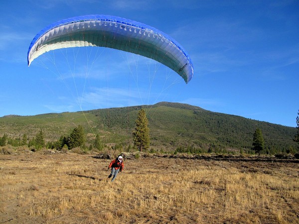
In general, The Whaleback is an intermediate to advanced level site. One of the keys to flying The Whaleback is to match your skills to the time of day with appropriate weather conditions. Novice-rated pilots (P2/H2) should only fly The Whaleback with an experienced mentor who can help evaluate conditions and all novice pilots should avoid mid-day flying altogether. Most often, The Whaleback is suitable for novice pilots only in the early to mid-morning and in the evening after thermals have weakened and winds have backed off. Even with the recent LZ expansion, novice HG pilots may find it on the small side and novice PG pilots may find it a test of skill to land in a grassy area.
All pilots flying in late morning and noontime are advised to monitor changing conditions as peak heating begins. Conditions suitable for intermediate pilots can quickly strengthen, leaving intermediate pilots flying in advanced conditions. This is a particular concern for landing as the small LZ heats and becomes increasingly thermic and windy. Advanced pilots will often find conditions suited for XC flights in the afternoon but, like all other pilots, need to be aware of evolving conditions. The Whaleback commonly overdevelops during sustained periods of high pressure, monsoonal flow, or post-frontal activity, even more so than surrounding peaks.
Launch & LZ
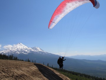
The launch works with NW to SW winds. The launch is a fairly flat slope with a steep drop-off: essentially this is a flat slope launch and all pilots must have the requisite skills and experience before launching here. All pilots must be able to fly off the top of the launch area without running down the drop-off. The launch is at 7437 ft. (2267 m.) MSL, making this a high altitude launch that is also greatly affected by density altitude (which often exceeds 10,000 ft. [3049 m.] equivalent). Flying on south wind days is not recommended. On these days, consider flying Herd Peak on the other side of Highway 97 from The Whaleback. East winds are over the back and should not be flown.
The primary LZ is visible from launch. Look for the rectangular clearing to the NW between launch and Highway 97. It is a 5:1 glide to the LZ and winds often become stronger as you descend closer to the LZ. Depending on wind direction, a pronounced wind gradient and turbulence may be encountered as the wind rolls off the tall treeline immediately SW of the LZ. Landing in the sagebrush short or long of the LZ is usually uneventful, however a few rocks are hidden amongst the bushes. All roads on the northeast side of Military Pass Road are closed to driving from August 15 to March 1. If you land out here, you will need to walk out to the Military Pass Road.
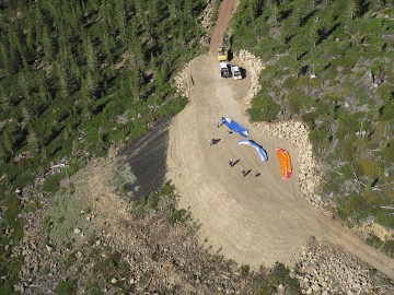
Parking is very limited at both the LZ and launch. Please carpool efficiently to launch and tightly park vehicles head-in at the parking area on the left as you arrive at launch. Please do not parallel park because this will restrict other vehicles from being able to park in the limited parking area after you. The parking area holds six vehicles on the launch, even fewer at the landing zone without parking on the shoulder of the road. Do not drive or park by the launch slope or layout area and do not block the roadway at either the launch or landing zone, even temporarily.
Cross Country
The Whaleback is a common launching point for XC flights, most of them heading north or northeast. Unless your route follows Highway 97, you’ll probably be flying over very remote and unforgiving forest, mountain, and lava terrain, much of it without easy (or any) road access or cell service. Detailed knowledge of flying routes, landing areas, and road access is essential to avoid long hikes out and/or an unintended night camping beneath your wing–this point cannot be overstated.
Pilots who regularly fly XC at The Whaleback carry maps, a GPS, a SPOT or other satellite location tracker, extra water, food, spare batteries, a headlamp, and enough clothing in the event they spend the night out before being retrieved. A supplemental oxygen tank is a good idea in July, August, and September as cloudbase is often over 14,000 feet (4300 m) MSL.
Mobile phone coverage is limited to a narrow corridor along Hwy 97. Cross country flights and retrieval vehicles following cross pilots cannot assume that there will be mobile services away from the immediate vicinity of Hwy 97. Radios and satellite trackers, Spot, Inreach are crucial in being able to communicate for safety and retrieval. It is not uncommon, even with radios to lose line of sight communication with the pilot or chase vehicle. Xc pilots are encouraged to obtain their FCC ham license in order to be able to access local repeaters in the area. Chase/ retrieval vehicles will frequently need to stay within the mobile access corridor until the xc pilot has signalled a landing or help needed signal. That allows the chase/retrieval access to xcfind or xctrack mapping locations.
Landing in the Lava Beds National Monument is prohibited and pilots may be arrested and have gear confiscated. It is up to pilots to know the monument boundaries and ensure that they are able to fully clear the monument before attempting to fly over it. Do not land in crop fields anywhere along XC routes. Sailplanes and military aircraft are frequently encountered along XC routes and near The Whaleback.
In short, The Whaleback is an advanced XC site and all pilots interested in flying XC here should carefully study maps, planned routes, and alternate routes. First time Whaleback cross country flights should be made with an experienced Whaleback XC pilot. This is not the place to try your first XC flight! All XC pilots and retrieve drivers should have the following paper maps: Klamath National Forest, Modoc Country, and Upper Klamath Basin. The DeLorme California Atlas & Gazetteer is very useful for retrieve but should not be relied upon exclusively. The BLM Lakeview District map is key for those really long flights northeastward.
Other
There are no amenities at The Whaleback. The nearest towns and services to the LZ are Weed (14 miles / 23 km south) and Macdoel (25 miles / 40 km north), both on Highway 97. Gas is also available along I-5 at Grenada and on Route A12 at Big Springs. Arrive at The Whaleback with a full tank and all the other supplies you will need for your visit. Yreka, Weed, and Mount Shasta have full services, stores, motels, etc. The Deer Mountain Snow Park is on the way to launch and has a pit toilet, picnic tables and pavilion, BBQ pits, and a forested camping area but no water source.
Getting to The Whaleback
Lat/Long: 41.534,-122.153
Lat/Long: 41.5505,-122.2
The Whaleback is the first broad peak rising to the north of Mt. Shasta, about 15 miles north of Weed, CA on US Highway 97. The primary LZ is located a little more than ½ mile east of US Highway 97 on Military Pass Road. Look for a small parking area on the northeast (left) side of the road. A short trail leads to the LZ, which is not readily visible from the parking area. To reach launch from the LZ, return to Highway 97, go north two miles and turn east onto Deer Mountain Road (Forest Road 19). Follow this paved forest road past the Deer Mountain Snow Park then turn right onto dirt road 42N24, six miles from Highway 97. After 3.1 miles on 42N24, turn right onto unsigned road 42N24A and go 1.6 miles to the launch area. It takes about 35 minutes to drive from the LZ to launch. The road to launch is blocked by snowpack for much of the year but can usually be reached by late June or early July. It is usually snowed in again by early to mid-November. Every year is a bit different. 4WD trucks may be needed if patches of snow and ice remain, otherwise 2WD cars can reach launch. Parking on launch is extremely limited and space to turnaround is tight. Please carpool efficiently to launch and park tightly head-in in the designated parking area. Do not park by the launch slope or layout area.
Support The Whaleback Flying Site
RVHPA spends considerable effort and money to insure, maintain, and enhance The Whaleback flying site. Please support this work by becoming a member of RVHPA or by making an quick online donation.
Site History
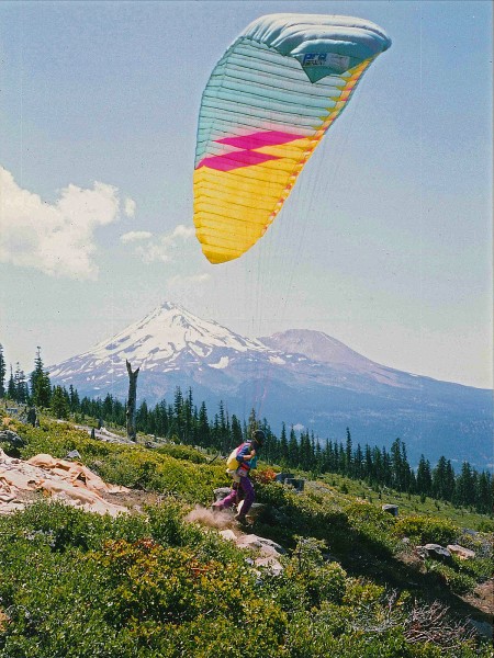
Legend has it that sometime around 1989, local area paraglider pilot Jim Yates flew from Herd Peak to The Whaleback and identified a potential launch site while thermalling higher and higher. The rest is history: pilots have been enjoying amazing flights from The Whaleback for 20 years.
In the early days, pilots launched from a small, carpeted strip surrounded by brush. The carpet can still be seen in the bushes southwest of the new launch. In the mid-90′s, a local club, the Northern California Foot Launched Pilots Association, built the current launch and kept a small LZ cleared below. It was suitable for paragliders but the relatively few hang glider pilots who flew The Whaleback preferred making it a couple extra miles to land in the (then) larger Herd Peak LZ. Between the mid-90’s and 2009, The Whaleback flying site was not regularly maintained. Sagebrush overtook the LZ, shrinking it to the point that it became a deterrent to flying The Whaleback for many pilots. Use of the site slowly declined but a core group of Shasta Valley pilots and a few RVHPA members continued flying there fairly regularly.
In late 2009, the Rogue Valley Hang Gliding & Paragliding Association, the current stewards of The Whaleback flying site, initiated The Whaleback Site Improvement Project with the goal of making The Whaleback a safer, more user-friendly site. With assistance from the Klamath National Forest in October 2009, RVHPA cleared the LZ of brush and enlarged it twenty-fold, making it safer and more accessible for all pilots of all skill levels. We planted native grass two years in a row to help make a grassy oasis amongst sagebrush flats. It will become greener as the grass takes hold.
RVHPA completed Phase 2 of The Whaleback Site Improvement Project in July 2011, expanding the launch to face a 90 degree window, adding a setup area, expanded parking and a vehicle turnaround. Hazard trees around the LZ were removed in August 2011. For more info on this amazing project, please see The Whaleback Site Improvement Project page.
In summer 2023, the Klamath National Forest cleared brush from the Military Pass Road landing zone as part of a project to create ground disturbance that benefits the endangered Cooke’s phacelia wildflower as well as free flight pilots who land there. The clear area of the landing zone was enlarged slightly in the east-west direction.
Site Records
Hayden Glatte set the current paraglider site open distance record on July 17, 2018 with a flight ending southwest of Badger Mt. Nevada (143 miles / 230.5 km). Details of the current hang glider site distance record are a bit murkier: a pilot is rumored to have made it to the Klamath Falls area in the 1990’s (approx. 40 miles / 64 km). The site altitude record is 17,999 feet (5486 m) MSL, set by paraglider pilot Brian Kerr in 2004.
